
PROJECT LOCATION AND RESEARCH:
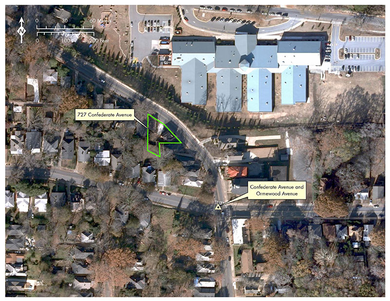
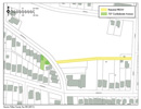
Intersection improvements are planned at Ormewood and Confederate avenues in the Grant Park neighborhood of Atlanta, Georgia. The APE extends in all directions from the intersection (Figure 1).

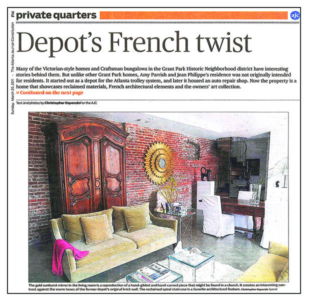
Prior to work, a story is published in the newspaper about a former streetcar-related building at 727 Confederate Avenue located within the APE (Figure 2).
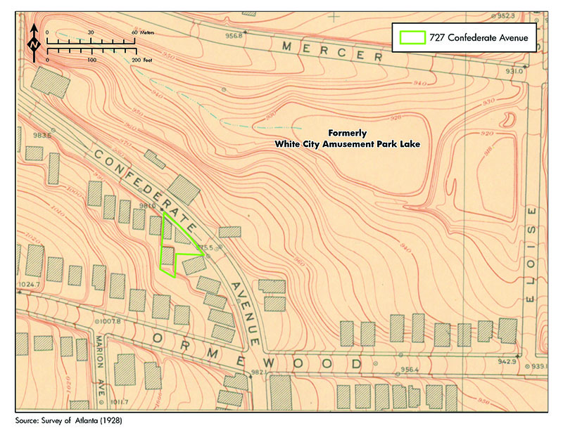
Research begins in applicable databases and repositories. GNAHRGIS revealed the project area falls within the Grant Park National Register Historic District. The Atlanta streetcar GIS Database indicates Confederate Avenue was single-tracked by Georgia Power by 1928, and three commercial/industrial buildings were present at 727 Confederate Avenue (Figure 3).
A search of the Fulton County Property Tax Database reveals late twentieth-century photography showing the buildings as an active automobile shop, with two buildings photographed. The shape and orientation of parcel boundaries are unique on the street and are suggestive of industrial or commercial usages.
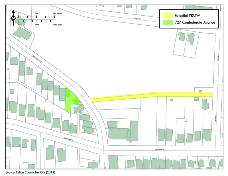
Additionally, parcel boundaries reveal a corridor evident between Confederate Avenue and Eloise Street and directly across from the buildings that may potentially represent private right-of-way (Figure 4).
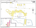
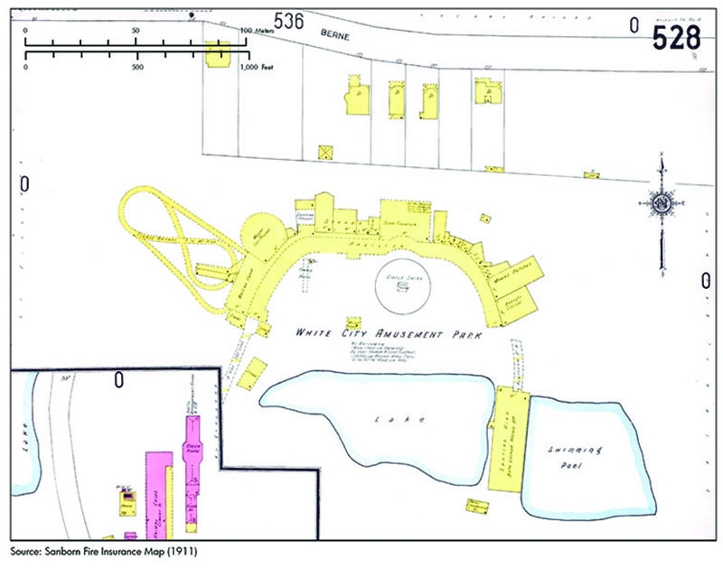
Figure 5. 1911 Sanborn Fire Insurance Map of Project Area Source: Digital Library of Georgia.
Figure 5
Online research of trade journals exposes the planned interurban line of the "Atlanta and Carolina Railway Company" in 1910 to originate from Confederate Avenue. Historic Sanborn Fire Insurance Maps from 1911 do not depict the project area, but feature the White City Amusement Park to the northeast. The same map also shows a building identified as a "small locomotive house" on the White City site and located in the vicinity of the private right-of-way as suggested by tax parcel boundary maps (Figure 5). Sanborn Maps from the mid-twentieth century show three buildings: two labeled as an auto repair shop with a dwelling behind them.
FIELDWORK:
The brick masonry two commercial and/or industrial buildings were once used as an automotive repair business and have more recently been extensively altered for residential use. The sites of the former White City Amusement Park and small locomotive house have been completely redeveloped and are now the location of the Parkside Elementary School.
Research documents the presence of a single-track line on Confederate Avenue by 1928 and two parallel cracks are currently evident in the street's pavement. The two buildings located at 727 Confederate Avenue have a footprint and orientation that suggest they may have been associated with the streetcar line. The project area is situated near a historic period recreation site, and anecdotal and trade journal research shows a possible connection of the buildings at 727 Confederate Avenue with a proposed interurban streetcar line as early as 1910. Examination of parcel boundaries reveals a potential off-street corridor of privately-owned right-of-way extending east connecting with the historic location of the White City Amusement Park and the locomotive house.
An intensive survey of paving and private right-of-way within the APE conducted with a GPR survey confirmed the presence of subsurface structures in the form of buried track and bedding material. Excavations in Confederate Avenue and within sections of the private right-of-way identified two types track. Grooved girder rail was identified within Confederate Avenue, as well as a siding of T-rail curving away from existing roadway. Gravel substrate likely associated with track bedding was also found within portions of the private right-of-way.
EVALUATION:
Subsequent deed research confirmed that the commercial/industrial buildings were first constructed around 1912 by the Atlanta and Carolina Railway Company. Residential reuse has heavily altered the buildings from their former role with additions and alterations in cladding and windows. However, original brickwork remains evident. The track and bedding resources suggests two periods of streetcar activity. The girder rail in the street was likely in service during the Georgia Power's operation of the line from the 1920s through the abandonment of streetcar service in the 1940s, while the T-rail may represent an earlier period of operation associated with the gravel substrate identified within the private right-of-way.
The project area's proximity to the historic location of a recreation site increases the potential for the presence of streetcar-related resources. It is likely the potential off-street corridor of right-of-way was associated with streetcar traffic within the amusement park. Though renovation has impacted the integrity of buildings, when viewed collectively the architecture, preserved track, and private right-of-way landscape features would likely contribute to the significance of the Grant Park Historic District at the local level under Criteria A, C, and D in the areas of transportation, engineering, community planning and development, and architecture.