 |
|||||
 |
|||||
ARCHAEOLOGY OF SPRINGFIELD
INTRODUCTION TO SPRINGFIELD ARCHAEOLOGY
SPRINGFIELDS’S HISTORIC LANDSCAPE
SPRINGFIELD HOUSE FROM THE RIVERFRONT AUGUSTA ARCHAEOLOGY STUDY
LIFE IN ANTEBELLUM SPRINGFIELD
CHANGE AND DIVERSITY IN POST-WAR SPRINGFIELD
THE NINIVIEN PIPE: A SYMBOL OF HOPE AND FREEDOM
AFRICAN AMERICAN ARCHAEOLOGY IN GEORGIA
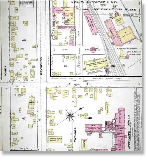
Sanborn Fire Insurance Maps also show urban development and growth. The 1884 map of Augusta shows the Springfield area lightly settled. Buildings are spread relatively far apart and are scattered within the block instead of being arranged according to the street grid. Buildings were mostly frame and the majority were houses. The presence of barns indicated a semi-rural character.
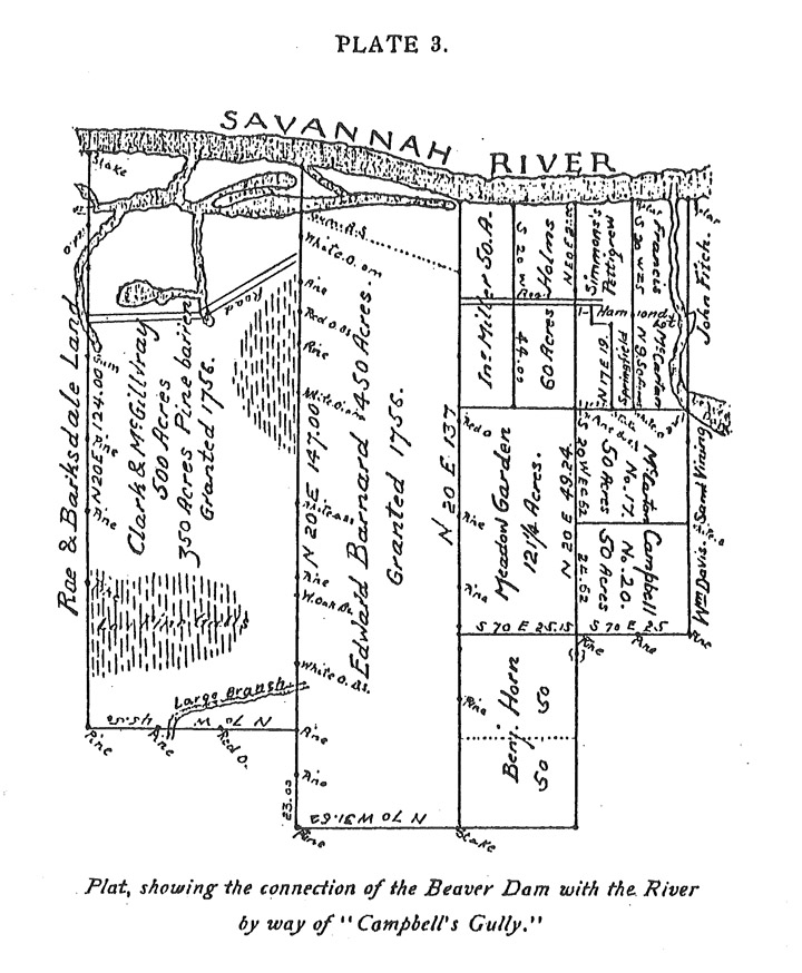
A 1759 plat showing the place name "Springfield." Aspects of Springfield's historic landscape and appearance can be pieced together from documents and archaeology. The community was located along the Savannah River and west of Campbell's Land (at the right-hand side of the map above). At the time of the earliest African American settlements there, the district probably contained mostly undeveloped flood-prone zones adjacent to the river. The plat shows a braided riverbank, which would have flooded often and been less desirable for development.
|
SPRINGFIELD’S HISTORIC LANDSCAPE In the 1780s, merchant Leonard Marbury obtained large riverfront properties in the Springfield area and began laying out streets and town lots. Although African Americans probably began settling here before Marbury bought the land, his plans became the basis for the cityscape that eventually grew up in Springfield. Even though Leonard Marbury laid out streets on paper in the 1780s, early settlement in Springfield probably did not follow his plan. African Americans early occupations and activities would not be aligned with the town grid because they had been using this area since before the plans were developed.
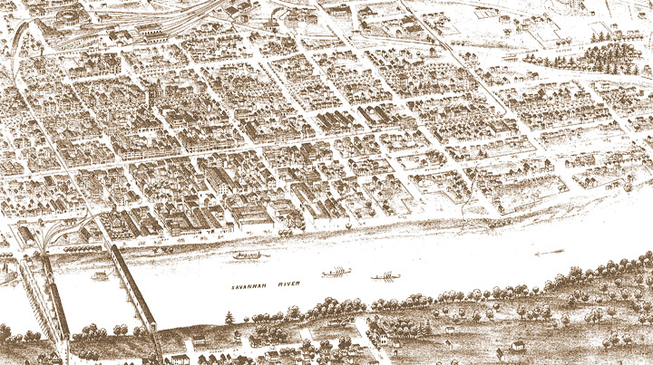
McKie’s Bird’s Eye View of Augusta, Dated to 1872. The Springfield neighborhood lies between the river and Jones Street and between Campbell (Ninth) and Mill (Fifteenth) streets. This is the first illustration of Springfield, and shows the neighborhood as less built up than other parts of the city and only loosely aligned with the street grid |