
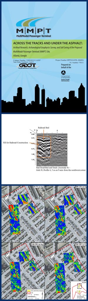
The Georgia Multi-Modal Passenger Terminal (Georgia MMPT) Project assessed the merger of rail and bus transit services in a centralized downtown Atlanta location. The Georgia MMPT was envisioned as a hub for existing and proposed transportation networks, including Metropolitan Atlanta Rapid Transit Authority (MARTA) rail and buses, Georgia Regional Transportation Authority (GRTA) Xpress buses, Megabus, Greyhound intercity bus, and planned intercity and commuter rail service. The project area is in “The Gulch,” a section of central Atlanta historically associated with railroad use and the city’s early development. As part of the project’s environmental review, New South Associates, in conjunction with Edwards-Pitman Environmental, Inc., conducted historical and archaeological investigations at the site. The project was conducted on behalf of HNTB Corporation for the Georgia Department of Transportation (GDOT).
 The study area’s close association with transportation dates to the founding of Atlanta. In the early nineteenth century, surveyors laid out a junction of three rail lines beside a ravine, a feature that became known as the Gulch. Atlanta emerged as the South’s chief rail hub, and the area contained numerous railroad support structures which were severely damaged and destroyed as a result of the Civil War. Rebuilding the railroad infrastructure began soon after the War, a process that went hand-in-hand with industrial and population growth. The Gulch was filled and made into a track yard for the Atlanta Terminal Station in the early 1900s, and the area continued to serve freight and passenger traffic until the automobile eclipsed rail travel. Eventually, most lines passing through Atlanta transferred freight operations to other rail yards, while passenger use was largely discontinued. Terminals were demolished, tracks were replaced with parking lots, and the industrial and municipal structures that paralleled the tracks were abandoned or replaced with modern office buildings and entertainment venues.
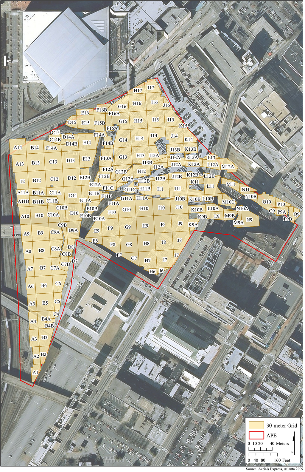
Map showing location of GPR survey grids
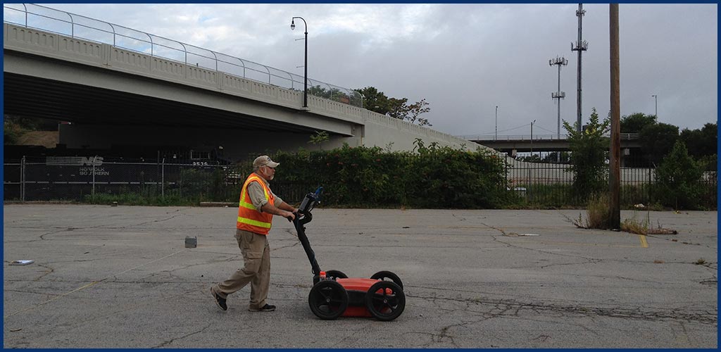
Reference to this historical development provided a basis for interpreting the archaeological remains in the study area. Archaeological investigations included soil coring and ground penetrating radar (GPR) survey. Soil coring revealed fill up to 45 feet deep in some areas and provided data to reconstruct the original terrain of the Gulch. The GPR focused on about 24 acres in the central portion of the Gulch to identify potential archaeological features, making it one of the largest urban geophysical surveys conducted in the world. This work identified 243 anomalies that reflected seven archaeological feature types: rail, structural, debris, utility, surface, topography, and unknown. Most were rail and structural features, many of which appear in good physical condition, and a number of them correlate with historic maps and aerial photographs of the area. Combining the archaeological data with historic maps and information from other sources allowed the historic landscape to be evaluated and potential effects on archaeological resources to be assessed.
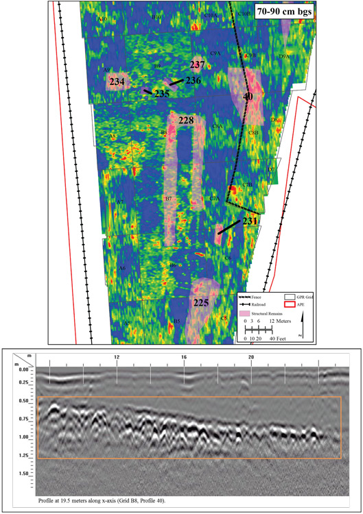
Plan and profile detail of a structural anomaly